Pages

Wednesday, August 7, 2013

Geological Hazards

geologic hazard is one of several types of adverse geologic conditions capable of causing damage or loss of property and life. These hazards consist of sudden phenomena and slow phenomena:


Here are some phenomenon like:

Avalanche- An avalanche (also called a snowslide or snowslip) is a rapid flow of snow down a slope. Avalanches are typically triggered in a starting zone from a mechanical failure in the snowpack (slab avalanche) when the forces on the snow exceed its strength but sometimes only with gradually widening (loose snow avalanche). After initiation, avalanches usually accelerate rapidly and grow in mass and volume as they entrain more snow. If the avalanche moves fast enough some of the snow may mix with the air forming a powder snow avalanche, which is a type of gravity current.


An earthquake (also known as a quaketremor or temblor) is the result of a sudden release of energy in the Earth's crust that creates seismic waves. Theseismicityseismism or seismic activity of an area refers to the frequency, type and size of earthquakes experienced over a period of time

At the Earth's surface, earthquakes manifest themselves by shaking and sometimes displacement of the ground. When the epicenter of a large earthquake is located offshore, the seabed may be displaced sufficiently to cause a tsunami. Earthquakes can also trigger landslides, and occasionally volcanic activity.


Tropical Depression

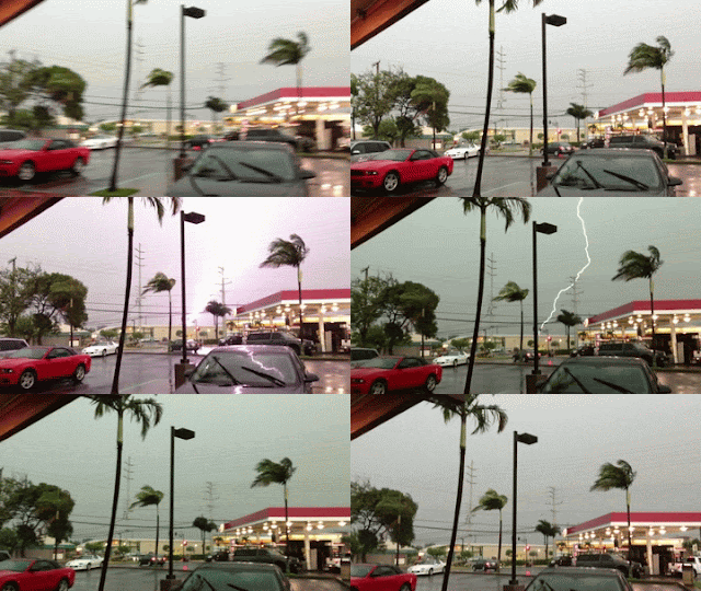
tropical cyclone is a rapidly-rotating storm system characterized by a low-pressure center, strong winds, and a spiral arrangement of thunderstorms that produce heavy rain. Tropical cyclones typically form over large bodies of relatively warm water. They derive their energy from the evaporation of water from theocean surface, which ultimately recondenses into clouds and rain when moist air rises and cools to saturation. This energy source differs from that of mid-latitude cyclonic storms, such as nor'easters and European windstorms, which are fueled primarily by horizontal temperature contrasts. The strong rotating winds of a tropical cyclone are a result of the (partial) conservation of angular momentum imparted by the Earth's rotation as air flows inwards toward the axis of rotation. As a result, they rarely form within 2° of the equator.Tropical cyclones are typically between 100 and 4,000 km (62 and 2,500 mi) in diameter.


The term "tropical" refers to the geographical origin of these systems, which usually form over the tropical oceans. The term "cyclone" refers to their cyclonic nature, with wind blowing counterclockwise in the Northern Hemisphere and clockwise in the Southern Hemisphere. The opposite direction of circulation is due to the Coriolis force. Depending on its location and strength, a tropical cyclone is referred to by names such as hurricane, tropical depression, and simply cyclone.
In addition to strong winds and rain, tropical cyclones are capable of generating high waves, damaging storm surge, and tornadoes. They typically weaken rapidly over land where they are cut off from their primary energy source. For this reason, coastal regions are particularly vulnerable to damage from a tropical cyclone as compared to inland regions. Heavy rains, however, can cause significant flooding inland, and storm surges can produce extensive coastal flooding up to 40 kilometres (25 mi) from the coastline. Though their effects on human populations are often devastating, tropical cyclones can relieve drought conditions. They also carry heat energy away from the tropics and transport it toward temperate latitudes, which may play an important role in modulating regional and global climate.

Intertropical Convergence Zone

What is ITCZ?

The Inter Tropical Convergence Zone, or ITCZ, is a belt of low pressure which circles the Earth near the equator where the trade winds of the Northern and Southern Hemispheres come together. It is characterised by convective activity which generates often vigorous thunderstorms over large areas. It is most active over continental land masses by day and relatively less active over the oceans.

The position of the ITCZ varies with the seasons. In July, over the Atlantic and Pacific, the ITCZ is between 5 and 15 degrees north of the Equator, but further north over the land masses of Africa and Asia. In January, over the Atlantic, the ITCZ sits no further south than the Equator, but extends much further south over South America, Southern Africa, and towards Australia. Over land, the ITCZ tends to follow the sun's zenith point.
Where the trade winds are weak, the ITCZ is characterised by isolated Cumulus (Cu) and Cumulonimbus (Cb) cells. However, where the trade winds are stronger, the ITCZ can be a solid line of active Cb cells embedded with other cloud types developing as a result of instability at higher levels. Cb tops can reach and sometimes exceed an altitude of 55,000 feet, and the ITCZ can be as wide as 300 nautical miles in places presenting a formidable obstacle to aircraft transit.

Aircraft flying through the ITCZ will encounter all the hazards associated with Cb clouds such as icingturbulencelightning, and wind shear. However, it is in this zone that the most severe effects may often be encountered. In particular, it is within the ITCZ that convective breakthroughs of the tropopause often occur, with the majority occurring over land especially in the second half of each day. Convective penetration of the tropopause is less common over oceanic areas where the phenomenon is more likely to occur in the early hours of each day, generating more isolated cells. Research sponsored by NASA has shown that 1% of tropical deep convective activity exceeds 46,000 ft altitude, with a small proportion of this reaching much greater heights. For further information on the potential hazards of transit through or near Cb cloud, see the article Cumulonimbus.
 
Black Moustache